giscloud.com
GIS Cloud is a real-time mapping platform for field data collection, operations management, and collaboration. It works online, offline and on-premises.
Description
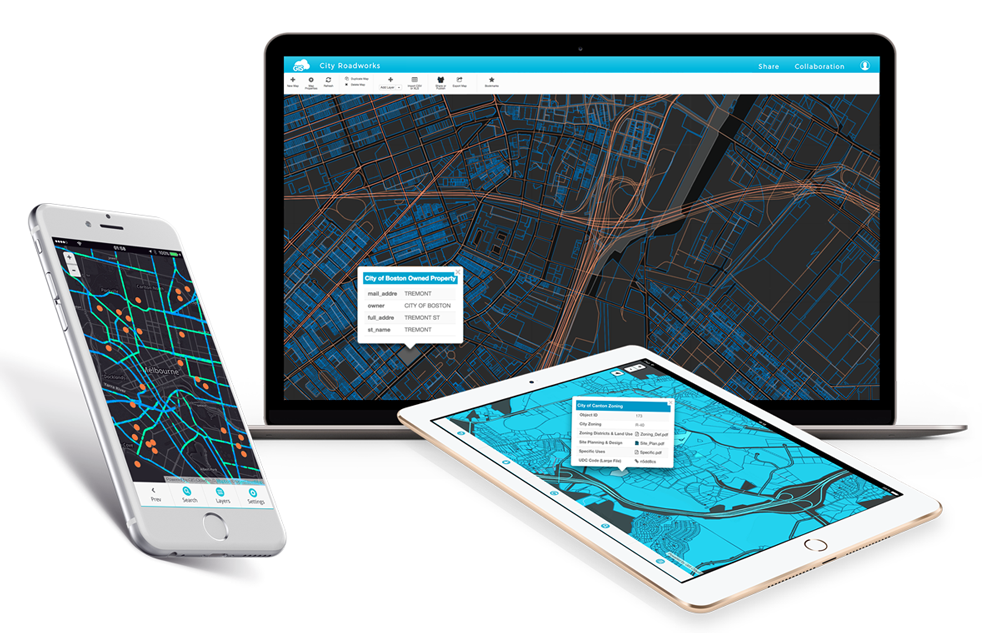
GISCloud is a comprehensive cloud-based Geographic Information System (GIS) platform designed to provide organizations and individuals with the tools necessary to create, manage, and share geospatial data. It caters to various industries including urban planning, environmental management, transportation, and more, by enabling them to visualize and analyze spatial information effectively.
Key Features
-
Web Mapping: GISCloud allows users to build interactive web maps that can be customized and embedded into websites or shared with stakeholders. Users can choose from various base maps and overlay them with their own data layers for enhanced visualization.
-
Data Management: Users can upload, store, and manage geospatial data such as shapefiles, KML, and GeoJSON in the cloud. The platform supports data editing, versioning, and spatial querying, making it easier to maintain accurate datasets.
-
Collaboration: GISCloud supports collaboration among team members, allowing multiple users to work on the same project simultaneously. The platform offers tools for sharing maps and data with clients or the public while controlling access permissions.
-
Data Analysis Tools: The platform includes various analytical tools to perform spatial analysis, measure distances, create heatmaps, and conduct field surveys. These tools are built to assist users in deriving meaningful insights from their geospatial data.
-
Mobile Access: GISCloud offers mobile applications that enable users to collect data in the field using mobile devices. The applications provide offline access to maps and allow users to sync data back to the cloud once connectivity is restored.
-
Integrations: GISCloud can be integrated with other software applications and GIS tools, enabling users to extend its functionalities and connect it with their existing tools for a seamless workflow.
Target Audience
GISCloud is ideal for government agencies, environmental organizations, urban planners, and businesses requiring robust GIS capabilities without the overhead of maintaining an on-premises infrastructure.
Pricing Model
GISCloud employs a subscription-based pricing model, allowing users to select plans based on their specific needs, whether for individual use or for teams requiring extensive collaboration features.
Conclusion
GISCloud provides a powerful environment for geospatial data visualization and analysis. With its user-friendly interface and robust feature set, it serves as an essential tool for organizations looking to leverage geographical data to drive informed decision-making.